|
|
|
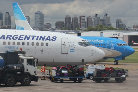
Year off in South America January 2013
|
|||||||||||||||||||||||||||||||||||||||||||||||||||||||||||||||||||||
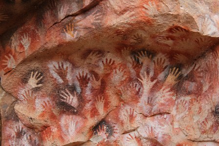 < Previous: Cueva de Las Manos |
 < Argentina > |
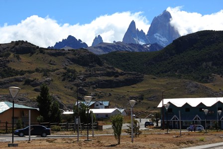 Next : El Chaltén > |
|||||
| < Begin Trip > | < Another Country > | ||||||

Custom Search
|
|
 |
The number 40 is a mythical one. |
 |
Quite an endless road by the way. With more than 5000 kilometres, Ruta 40 is the longest road in Argentina, and one of the longest in the world. It starts in La Quiaca, near the border with Bolivia, and ends in Cabo Vírgenes, near Rio Gallegos. Getting further south to Ushuaia in the Island of Tierra del Fuego requires flying, sailing, or driving via Chile. |
 |
Once you're in Ruta 40, you're in for a long journey. For us, it started with a night bus ride from Bariloche to Perito Moreno. The landscape around Bariloche is very green and mountainous. But it doesn't take long until it starts to feel dryer. |
 |
This city is on a large plateau, but high peaks are never too far. A 10 km detour from Ruta 40 leads to Lago Buenos Aires. |
 |
|
 |
But we did visit the Cueva de las Manos while in Perito Moreno, and for that, we drove 98 kilometres on Ruta 40, plus an unpaved tegional road for the remaining 28 kilometres. |
 |
We took a day bus from Perito Moreno to El Chaltén. |
 |
Dozens of wild animals roam the fields on each side of the road. Guanacos, Choiques and herds are the most common. We weren't lucky enough to spot a puma, but they roam all around Ruta 40. |
 |
The steppe can be quite monotonous. Every now and then some white peaks appeared in the distance but still, the road looks the same for hours and hours. Most of the southern part of Ruta 40 hasn't been asphalted yet, so it's a jumpy ride, even when driving slow. Paving is on the works and we saw parts of the forthcoming paved segments. We heard it should be finished by 2015. |
 |
The region also can be very windy. The wind can blow up to 90km/h, adding even more difficulties to this long drive. |
 |
|
 |
We encountered the Ruta 40 more than any other road during our trip to Patagonia. We spent some unforgettable moments there and it made us reach some amazing places! |
 |
Argentina Links:
|
 |
|
|
Custom Search
|
|
< Previous: Cueva de Las Manos |
< Argentina > |
Next : El Chaltén > |
|||||
| < Begin Trip > | < Another Country > | ||||||